Parish Boundaries
<< Back to Parish Information
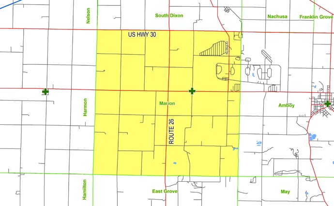
| North: | Starting at the intersection of Hoyle Road and US Highway 30: east on US Highway 30 to the Marion/Amboy township line. |
| East: | Starting at the intersection of US Highway 30 and the Marion/Amboy township line; south on the Marion/Amboy township line (Corregidor Road) to Sleepy Hollow Road |
| South: | Starting at the intersection of the Marion/Amboy township line and Sleepy Hollow Road: west on Sleepy Hollow Road to the Marion/East Grove township line (Sleepy Hollow Road, Arch Road) to Hoyle Road. |
| West: | Starting at the intersection of Arch Road and Hoyle Road: north on Hoyle Road to US Highway 30. |