Parish Boundaries
<< Back to Parish Information
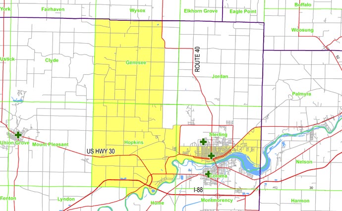
| North: | Starting at the intersection of the Clyde/Genesee township line and the Carroll/Whiteside county line: east on the Carroll/Whiteside county line to Luther Road (Illinois Route 40); south on Luther Road to West Science Ridge Street (West 37th Street); east on West Science Ridge Street to McCue Road; south on McCue Road to West Le Fevre Road; east on West Le Fevre Road (East 17th Street) to Freeport Road; south on Freeport Road to Illinois Route 2 (East Lincolnway); east on Illinois Route 2 to the Lee/Whiteside county line. |
| East: | Starting at the intersection of the Lee/Whiteside county line and Illinois Route 2: south on the Lee/Whiteside county line to the Rock River. |
| South: | Starting at the intersection of the Lee/Whiteside county line and the Rock River: west along the Rock River to the Hopkins/Lyndon township line; north and west on the Hopkins/Lyndon township line to the Hopkins/Mount Pleasant township line. |
| West: | Starting at the intersection of the Lee/Whiteside county line and the Rock River: west along the Rock River to the Hopkins/Lyndon township line; north and west on the Hopkins/Lyndon township line to the Hopkins/Mount Pleasant township line. |